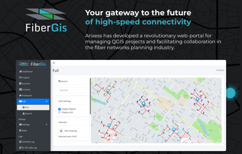
A QGIS projects & Assets Management Tool
A collaborative tool for team work on QGIS projects for fibre networks planning and surveying
FiberGIS specialises in delivering quality planning and design services to new and established telecommunications service providers in the UK.
*The actual business name has been altered in accordance with a non-disclosure agreement (NDA).
The main challenge faced in developing the web-portal was creating an integrated solution that could automatically pull data from the Openreach portal, manage QGIS projects and versions, facilitate real-time collaboration, communication, and asset information collection. The team also had to ensure that the portal’s surveying process was streamlined and efficient for asset management purposes. Overcoming these challenges required a comprehensive understanding of QGIS project structure and how it can be most efficiently displayed in web.
The web-portal is a powerful solution designed for effective visualization and collaboration on QGIS projects. With the ability to automatically pull data from the Openreach portal, manage QGIS projects and versions, and provide real-time collaboration and communication tools, the platform has become an indispensable tool for the client.
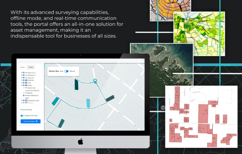
One of the most notable features of the portal is the ability to work with QGIS projects in an offline mode. This is particularly important for the client who works in remote locations with limited internet connectivity. With the offline mode feature, users can easily download the necessary project files and work on them even without an active internet connection. Once they are back online, the portal automatically synchronizes any changes made to the project files.
In addition to the offline mode feature, the portal also offers advanced surveying capabilities, allowing users to collect information about assets and integrate this data with their QGIS projects. This has significantly improved our clients’ ability to manage project assets and make informed decisions about the project planning.
Overall, the web-portal is a comprehensive solution that streamlines the management of QGIS projects, provides real-time collaboration and communication tools, and allows for offline work, making it an essential tool for professionals in the fiber networks planning industry.
Thanks to solutions offered by Arixess the results of the project have been overwhelmingly positive, with FiberGIS and their clients now able to collaborate seamlessly on Openreach data and QGIS projects. The portal has helped to streamline the process of working with Openreach data and has increased efficiency in building network infrastructure solutions. Additionally, the use of QGIS projects in the portal has allowed for more accurate planning and visualization of network deployments, leading to a more informed decision-making process.

Fill out our form today and get a free, no-obligation cost estimate.